City of Winnipeg Neighbourhood Profiles
In partnership with local community organizations, other levels of Government and the Community Social Data Strategy, the City of Winnipeg has purchased 2006 Statistics Canada Census Data based on a variety of custom geographies. The City of Winnipeg is pleased to provide this community profile data for community use.
The previously posted 1996 and 2001 Census Data also remains accessible by clicking on the Census Profile tab at the top of this page. Every effort has been made to provide the data in a fashion that allows for trend analysis over the years.
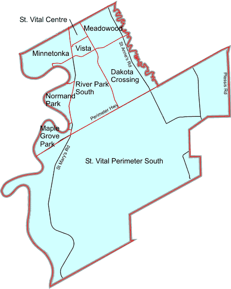
Click on the map to get information on a neighbourhood. Neighbourhood boundaries are indicated in red. Major streets are shown in black, unless they represent a neighbourhood boundary (shown in red).
◄ Back to Alphabetical Neighbourhood Listing

St. Vital South Neighbourhood Cluster
St. Vital South Neighbourhoods
Dakota Crossing
Dakota Crossing.pdf
Dakota Crossing.xls
Meadowood
Minnetonka
Normand Park
Normand Park.pdf
Normand Park.xls
River Park South
River Park South.pdf
River Park South.xls
St. Vital Perimeter South
St. Vital Perimeter South.pdf
St. Vital Perimeter South.xls
Vista
Last update: 03.09.2008* Top of Page
