Good Friday and Easter Monday – View holiday hours for City of Winnipeg facilities and services from April 3 to April 6.

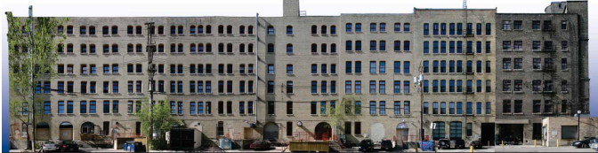
Downtown Urban Design Review
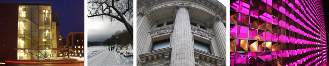
What is urban design?
Urban design is concerned with giving physical design direction to urban growth, conservation, and change. It is a way of shaping the public and semi-public spaces on streets and around buildings to create a high quality and livable urban environment. Urban design reflects consideration of function, economics and organization as well as aesthetic and cultural qualities. Paramount to good urban design is safety, accessibility and quality, elements which respond to the needs of a city and a community rather than individual tastes.
Why is urban design important?
The City recognizes urban design excellence is key to creating great communities and neighborhoods. High quality design can add economic, social and environmental value. It can produce high returns on investment, reduce management, maintenance, energy and security costs. Good design can also create well connected, accessible new places, enhance sense of safety and conserve urban heritage.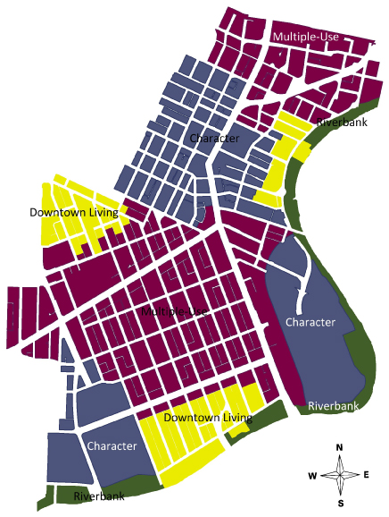
How do we guide and regulate urban design in the Downtown?
The Downtown Winnipeg Zoning By-Law 100/2004 separates the downtown into four sectors; Riverbank, Multiple-Use, Downtown Living and Character. Each sector has its own intent and offers direction on uses, built form and signage.
Further direction is provided by the Downtown Urban Design Guidelines. The principles found in these guidelines provide the basis for design review decisions. View the submission requirements for a downtown design review application requirements.
Additional guidance is provided by the following documents:
- OurWinnipeg
- Complete Communities
- West Alexander and Centennial Neighbourhood Plan (part of the Downtown)
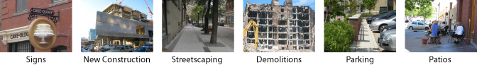
What do we review?
Downtown Winnipeg Zoning By-law 100/2004 250 (1) states:
"All Downtown Winnipeg development, redevelopment, expansion or exterior alteration visible from public rights-of-way or rivers is subject to urban design review".
This includes:
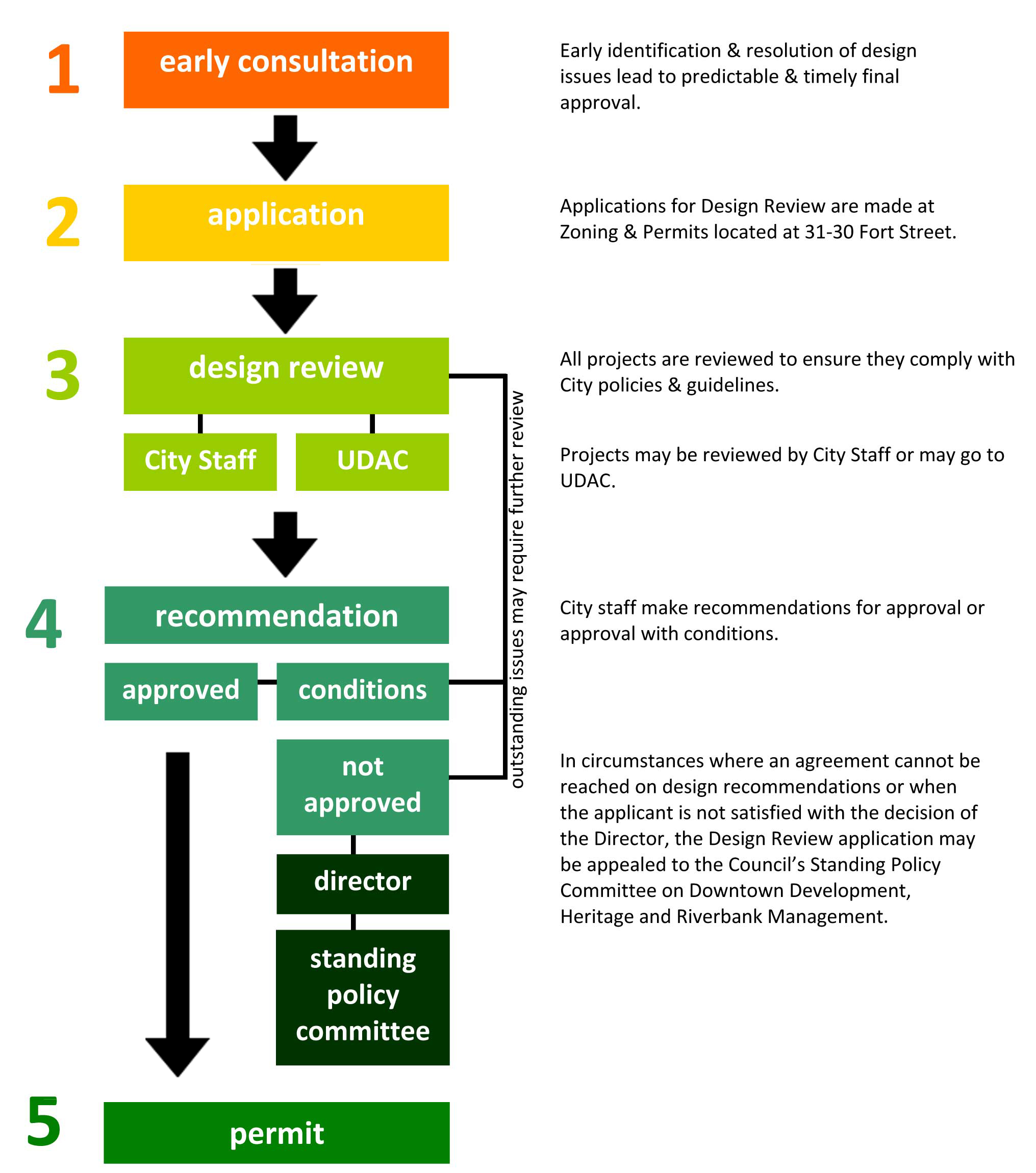
How are projects reviewed?
Projects may be reviewed two ways, by City of Winnipeg staff or by the Urban Design Advisory Committee (UDAC).
Who is on UDAC?
UDAC is composed of design and development professionals appointed by the Standing Policy Committee on Property and Development to provide expert advice to the Director of the Planning, Property & Development Depatment on urban design.
UDAC members are nominated by professional associations including: the Manitoba Association of Architects, the Manitoba Association of Landscape Architects, the Manitoba Professional Planners Institute, the Urban Development Institute and CentreVenture.
All members are volunteers, and graciously donate their time to the Urban Design Advisory Committee.
Which projects go to UDAC?
- New additions or new buildings of a significant size and scale
- Proposals that are significant because of their location in a sensitive context within the Downtown
- Proposals that may set a precedent and could impact the future decision making process
All other development projects are reviewed by the City of Winnipeg.
When are UDAC meetings held?
UDAC meetings are held the second Thursday of every month.
What are the steps in the Urban Design Review process?
What do I need to submit with my development application?
Each project is unique, however as a general guide, most applications require:
- Drawings to scale
- Architectural drawings and details (Plan, elevations, sections to help illustrate the design objectives)
- Landscape drawings and details
- Mechanical and electrical drawings on request
- North arrow, date and plan number
- Final stamped drawings
- Site plan
- All existing and new site features
- Location of new buildings/structures/elements
- Landscaping details, including pedestrian circulation facilities, plant materials, planters, walls, fences, paving materials, parking including materials, dimensions, etc.
- Location of refuse storage facilities
- Size and location of service infrastructure (transformer, gas...)
- Lighting detailing
- Context
- Site layout and dimensions of lot and existing site features
- Adjacent building lots and building footprints
- Streets, backlanes, street elements (sidewalks, para ramps, trees, signal boxes, light standards, hydrants, etc.)
- Private approaches (indicate cross fall gradient)
What do I need to submit with my application to UDAC?
The presentation package should provide sufficient detail to enable the Urban Design Advisory Committee to clearly understand the scope, purpose and details of the proposal. Plans and illustrations should fully illustrate the character and details of the design (as appropriate to the stage of design development and the scale of the project).
***Plans and illustrations must be submitted at least one week in advance, failure to do so may result in the postponement of the review
- Design statement
- Explain the design intent (objectives)
- Explain how design intent is reflected in the proposal's layout, scale, visual appearance and landscape
- Explain how the proposal relates to its wider context (through a full context appraisal where appropriate)
- Location plan
- Scale 1:1250
- North arrow, date and plan number
- Outline the application property
- Show the application property in relation to all adjoining properties and the immediate surrounding area, including roads and buildings on the other side of the street at minimum
- Context
- Scale 1:200
- North arrow, date and plan number
- Show the whole property, including all buildings, landscaped areas, open spaces and parking
- Tree survey, where appropriate
- Proposed site layout/site development plan
- Scale, typically 1:200
- North arrow, date and plan number
- Show the siting of any new building or addition, vehicular/pedestrian access, changes in levels, planted areas, new or altered boundary walls and fences
- New hard-surfaced open spaces
- Show proposal in the context of adjacent buildings, pedestrian circulation routes and crossings
- Photographs of the site and its surroundings
- Show existing buildings (if applicable)
- Exterior elevations of each side of the building(s)
- Details of the surrounding context including areas affected, site, block and neighbourhood (as appropriate)
- Elevations
- Scale 1:50 or 1:100
- Show every elevation of a new building or addition
- For an addition, clearly distinguish existing and proposed elevations
- Include details of materials and external appearance
- Elevations should extend some way beyond site boundaries to show the relationship of the proposal to surroundings. Long street elevations showing the proposal in context are particularly helpful. Drawings must be accurate.
- Cross sections (if appropriate)
- Scale 1:50 or 1:100 (consistent with floor plans)
- Other information
- 3-D drawings or model
- Perspectives should be accurate and drawn from a relevant viewpoint such an eye-level view of the street frontage
- Material samples
- Details of paving, site furnishing, planting, lighting, signage...
Where can I submit my application?
You can submit your application via Permits Online or submit digital copies of your application documents to ppd-zoningapplications@winnipeg.ca.
If you’re unable to submit your application digitally, you can mail, courier or drop off your application package to the Zoning and Permits Branch at 31-30 Fort Street.
For early consultation contact the senior urban designer at 204-986-4738
What if my building is a listed heritage building?
A building listed on the City of Winnipeg Historical Buildings Committee Buildings Conservation list also require heritage review.
Heritage and Urban Design Review generally occur concurrently.
For further information on Heritage Review, contact the Heritage Planner at 204-986-4722.
Last update:
December 3, 2025