Holiday season – View holiday hours for City of Winnipeg facilities and services from December 24 to January 1.

Chevrier Walk/Bike Improvements
The majority of construction on Chevrier Boulevard is complete, with landscaping and clean-up works to take place in Spring/Summer 2019.
The pedestrian and cycling improvement project encompassed 2.24 kilometers of Chevrier Boulevard in conjunction with road work. Work included raised bike lanes on Chevrier Boulevard from Waverley Street to Hervo Street and protected bike lanes on Chevrier Boulevard from Hervo Street to Pembina Highway. This project also included construction of a multi-use path on the east side of Waverley Street from Chevrier Boulevard to McGillivray Boulevard.
- Updates
- Timeline
- Engage
- Background
- Documents
- FAQs
- Maps
- Related Links
Updates
Update Winter 2019
The majority of construction on Chevrier Boulevard is complete, with landscaping and clean-up works to take place in Spring/Summer 2019. We will advise the public of any road closures as they are planned.
Engage
Thank you to all who attended the residents' meeting January 29, 2018.
The goals of stakeholder engagement are to:
- Inform residents of the project;
- Discuss potential impacts to on street parking; and
- Collect information on the pathway alignment.
If you have questions or concerns, please contact Andrew Condon at 204-619-0035 or acondon@winnipeg.ca.
If you would like to stay updated on City of Winnipeg public engagement events, follow the City on Facebook and Twitter, or sign up for the City of Winnipeg public engagement newsletter.
Background
Chevrier Boulevard was scheduled for construction as part of the 2018/2019 Industrial/Commercial Roads Renewals Program. The majority of construction was completed in 2018, with some minor secondary construction planned for 2019.
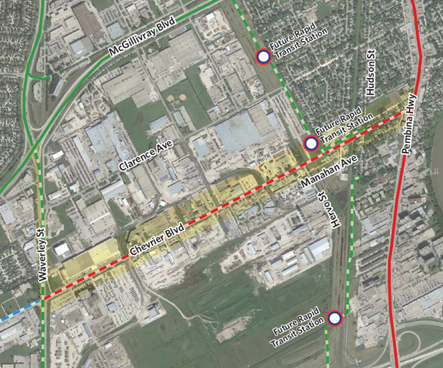
The Chevrier Walk/Bike Improvements project aimed to connect residents and businesses to the future Southwest Transitway Chevrier station and pathway. The western extent of the cycling route connection ties into the McGillivray Boulevard multi-use path and into the Waverley Street path that extends north to Taylor Avenue. The eastern extent of the bike lanes connect to the existing buffered bike lanes on Pembina Avenue from Chevrier Boulevard to Plaza Drive.
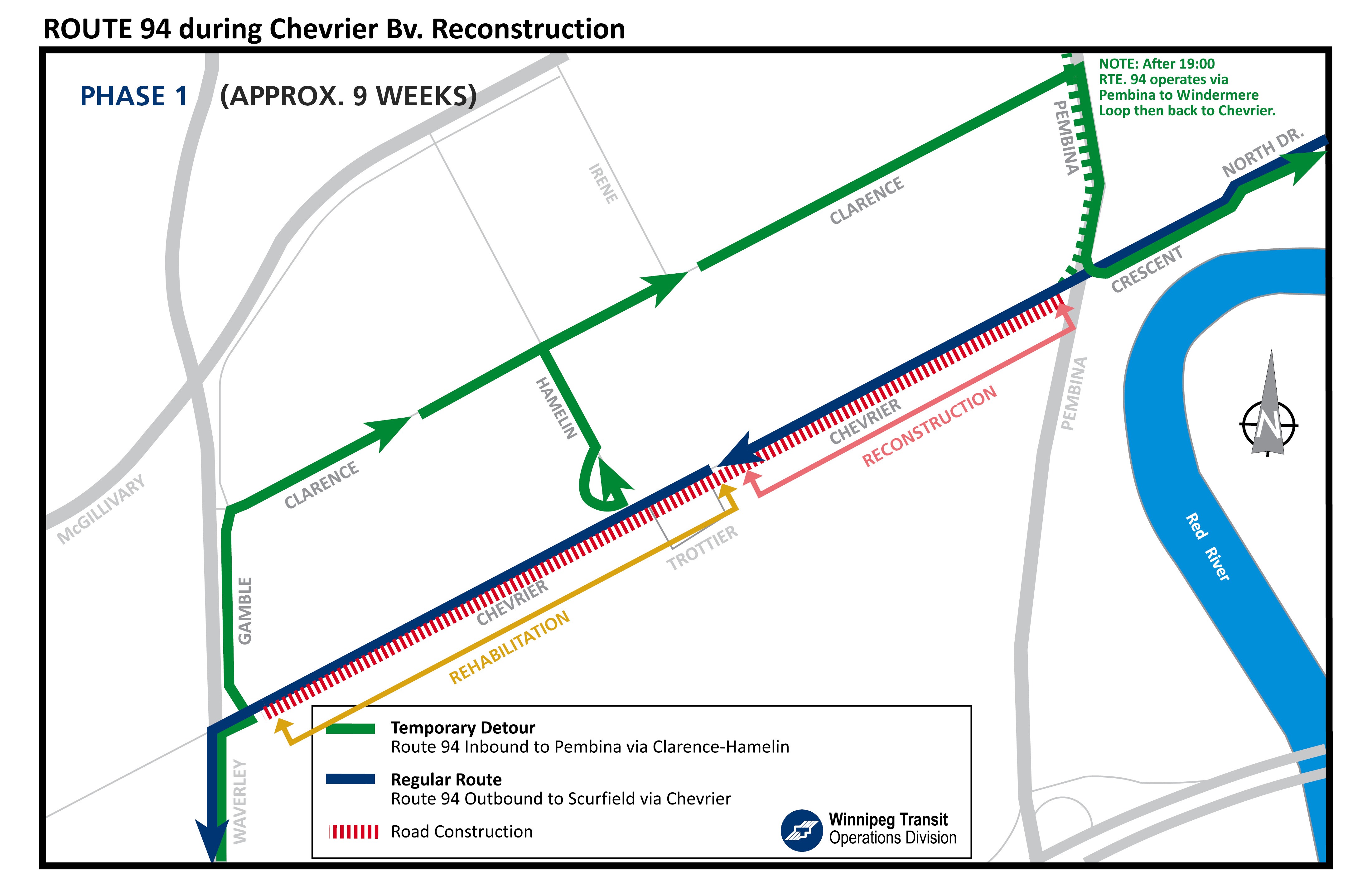
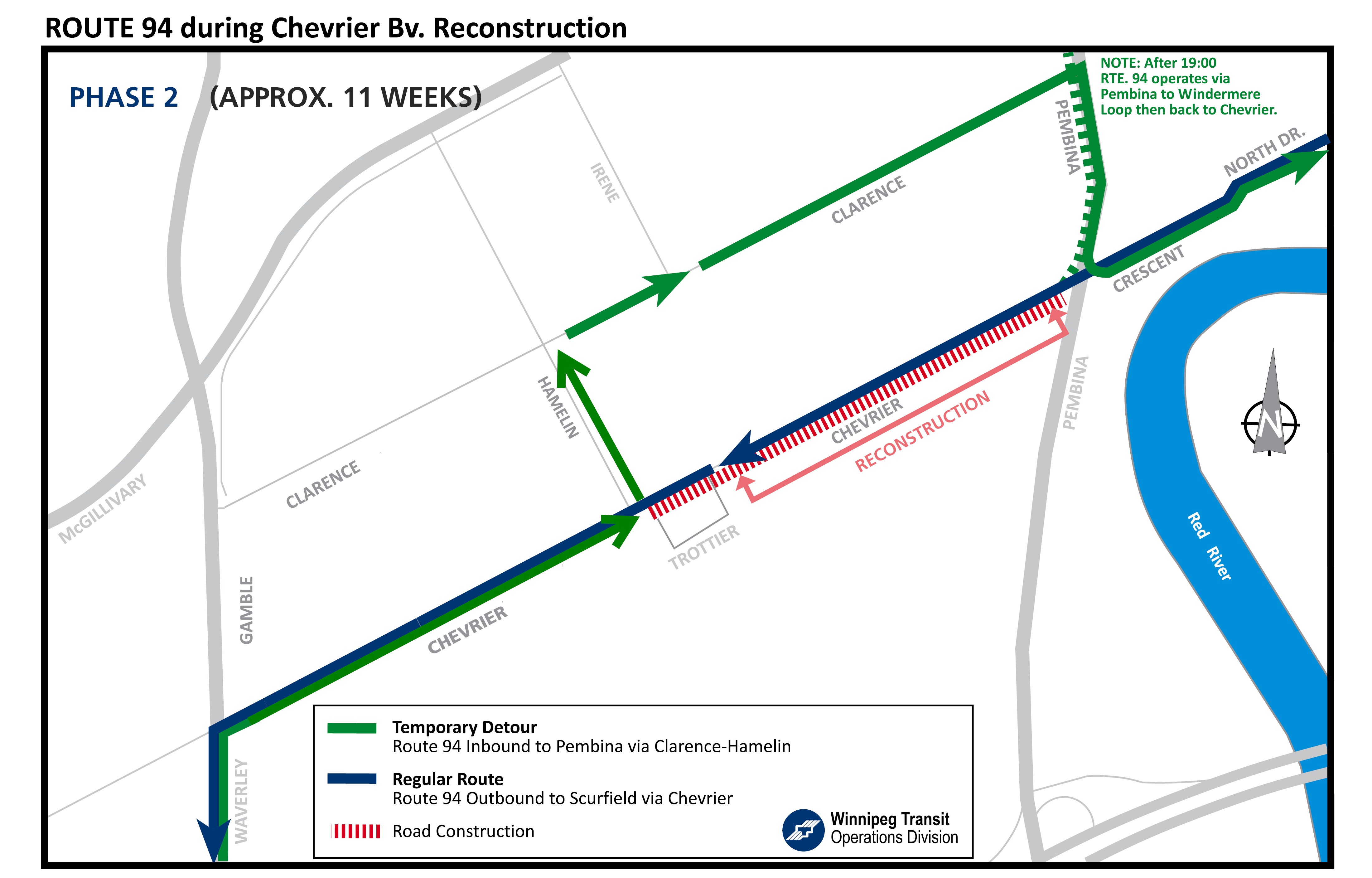
Road work on Chevrier Boulevard included a street replacement from Pembina Highway to Trottier Bay and street resurfacing from Trottier Bay to Waverley Street.
This project was approved for construction with cost-sharing funding from the Federal Government's Public Transit Infrastructure Fund (PTIF).
Documents
| Document Name | Date | Type |
|---|---|---|
| Pre-construction notice | 2018-04-18 | Community Letters |
| Construction notice | 2018-05-01 | Community Letters |
| Construction update | 2018-07-17 | Community Letters |
| Chevrier Boulevard design | 2018-08-15 | Drawings |
| Temporary Rail Crossing Closure Maps | 2018-09-27 | Drawings |
| Temporary Rail Crossing Closure Notices | 2018-09-27 | Community Letters |
Frequently Asked Questions
This project supports the ability for people to "trip-chain," allowing people to walk or cycle to the Bus Rapid Transit station as well to access bus routes on Pembina Highway. This project will connect residents and businesses to the future Southwest Transitway Chevrier station and pathway. The western extent of the cycling route connection will tie into the McGillivray Boulevard multi-use path and into the Waverley Street path that extends north to Taylor Avenue. The eastern extent of the bike lanes will connect to the existing buffered bike lanes on Pembina Avenue from Chevrier Boulevard to Plaza Drive.
Road work on Chevrier Boulevard included a street replacement from Pembina Highway to Trottier Bay and street resurfacing from Trottier Bay to Waverley Street.
The roadway from Waverley Street to Hervo Street remained 10 meters wide. The roadway from Hervo Street to Pembina Highway will be 7.5 meters wide with additional space for parking along certain sections.
Some minor road closures are expected in Spring/Summer 2019 (approximately 1-2 weeks' duration). Watch the Updates tab for information on closures.
The City is working to maintain as many trees as possible as part of the project, and any trees that are removed will be replaced at other locations in the city.
The improved cycling infrastructure design balances the needs of area businesses, service providers, visitors and residents. The final design maintains as much on-street parking and loading as possible.
A class 5 cost estimate (expected level of accuracy of +100% to – 50%) of $7.5 million was developed for the project.
Separating cyclists, pedestrians, and vehicles is the safest way to accommodate each mode of transportation. The City is committed to creating a pedestrian and cycling network that is safe and accessible for people of all ages and abilities.
The City is working on a number of studies and projects in advance and in conjunction with upcoming road renewal. The City has a multitude of competing spending priorities and limited resources. As such, the Public Works Department looks for efficiencies in construction costs and for opportunities to build cycling infrastructure in conjunction with road renewal. These projects happen throughout the city. Some of the projects included in the 2018 capital program, will close gaps that improve connectivity to the downtown and the core area. These are also high priority projects.
A key direction of the Pedestrian Cycling Strategies is to provide year-round opportunity for people to cycle by prioritizing a winter network. Infrastructure and pathway conditions can be more of a deterrent to winter cycling than winter temperatures. The City is designing cycling infrastructure with consideration for efficient snow removal. There is evidence to indicate that a properly maintained cycling network will be used year-round.


