Chief Peguis Trail Extension Project - PHASE 1 COMPLETE
Phase 1 of this project is now complete.
Please see Chief Peguis Trail Extension West for more information.
Maps & Images
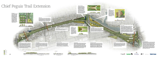
Aerial Map and Street Renderings - Updated March 2011
Click on each image to download a larger document.
|
Aerial Map |
|---|
 |
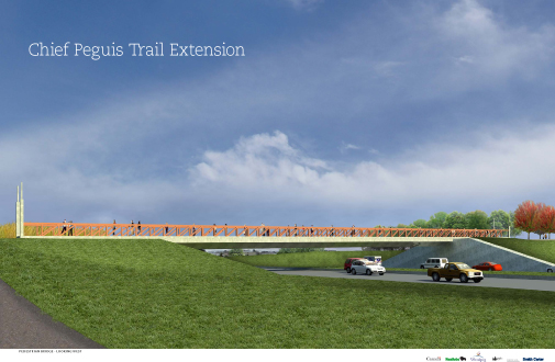
Streetscape View 1 |
 |
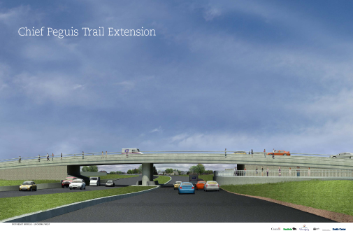
Streetscape View 2 |
 |
DBF2 Preliminary Design Drawings Oct 2010
The three DBF2 Preliminary design plans are based on the Design Build Financing and Maintenance (DBFM) Agreement, along with all related closing documentation, between The City of Winnipeg and DBF2 Limited Partnership signed September 17, 2010. The design plan includes:
- A grade separation at Rothesay Street - a new overpass structure will be built for Rothesay Street traffic including sidewalks on both sides.
- A multi-use pathway bridge - an new multi-use overpass will be constructed west of Gateway Road connecting to the Chief Peguis multi-use pathway to the Northeast Pioneer Greenway Corridor
- A pump station and dry pond - the pump station for the Rothesay grade separation (overpass) will be located east of Henderson Highway and will include a dry pond to accommodate peak rainfall events.
On July 21, 2010 City Council approved the recommendation of the Winnipeg Public Service to select DBF2 Ltd. as the Preferred Proponent for the Design, Build, Financing and Maintenance of the Grade Separation Alternative for the Chief Peguis Trail Extension Project.
Maps and drawings of the project:
- Section 1 Henderson Highway to Rothesay Street
- Section 2 Rothesay Street to Gateway Road
- Section 3 Gateway Road to Lagimodiere Boulevard
Contact Information: 311
Last update: 08.01.2020* Top of Page

